Hawaiʻi Community Wildfire
Mapping Resources
Hawaiʻi Community Wildfire Mapping Resources
Understanding Wildfire Hazards. Highlighting Risk Reduction.
The Hawaiʻi Wildfire Management Organization (HWMO) provides three complementary mapping resources to help communities better understand wildfire hazards in developed areas, explore ongoing mitigation projects, and learn how communities and partners are working to reduce wildfire risk across Hawaiʻi.
Understanding Wildfire Hazard vs. Risk
Wildfire hazard and wildfire risk are related, but they are not the same thing.
Wildfire hazard describes conditions that may contribute to wildfire occurrence or impacts. Wildfire risk considers the likelihood and potential consequences of wildfire under specific conditions, including factors that can change over time.
The Hawaiʻi Community Wildfire Hazard Inventory characterizes wildfire hazards, not property-specific wildfire risk. Its maps are intended for education and planning, not insurance or regulatory determinations.
Project Partners
Hawaiʻi Community Wildfire Hazard Inventory
The Hawaiʻi Community Wildfire Hazard Inventory was developed by the Hawaiʻi Wildfire Management Organization in partnership with Hawaiian Electric and the Hawaiʻi Department of Land and Natural Resources, Division of Forestry and Wildlife (DLNR-DOFAW).
Special mahalo to the County of Kauaʻi Planning Department for its contributions to the project.
Mitigation Dashboard & Wildfire StoryMaps
Development of the Mitigation Dashboard and Wildfire StoryMaps was supported by funding from the U.S. Forest Service (USFS).
Hawaiʻi Community Wildfire Hazard Inventory
Understand the Hazard
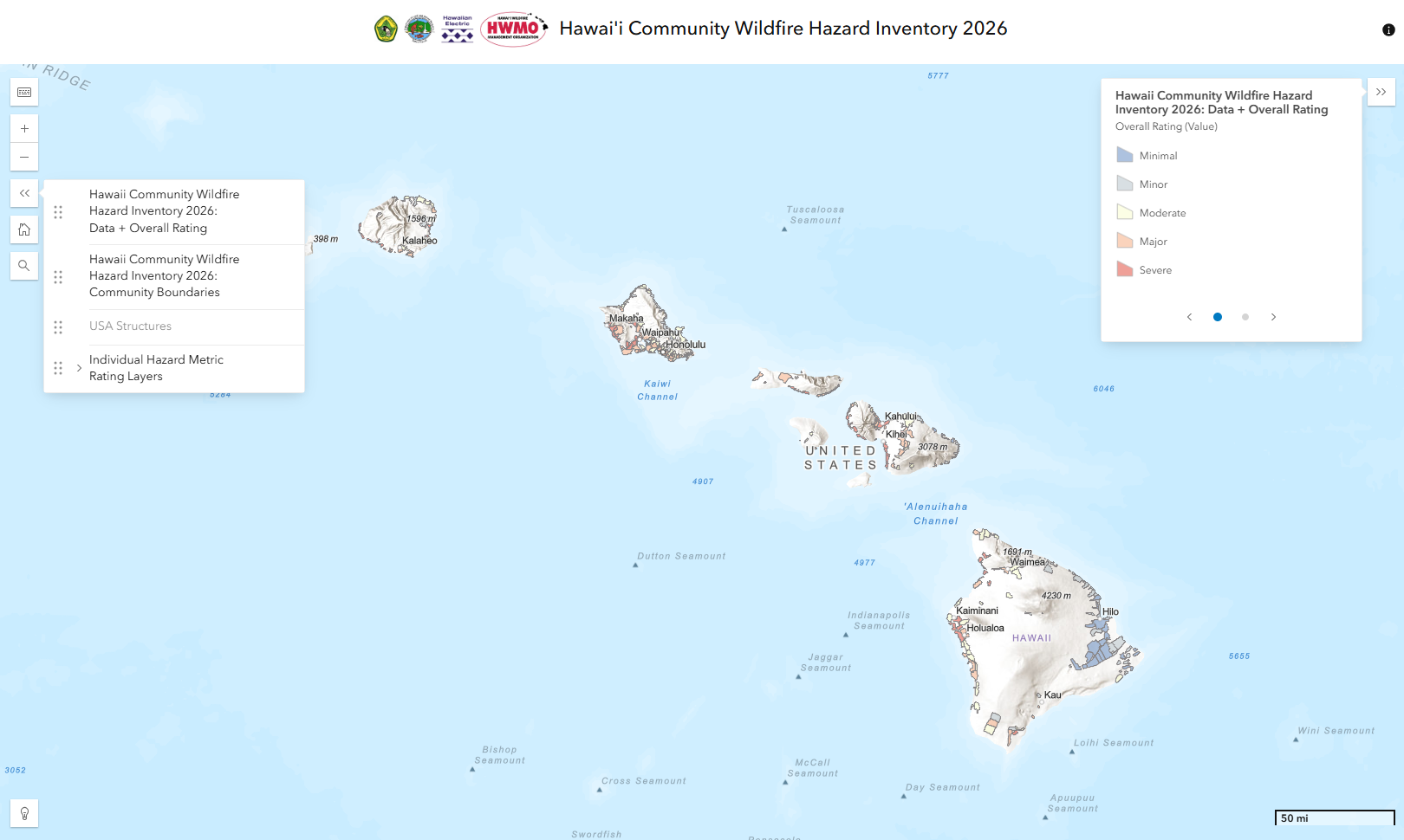
The Hawaiʻi Community Wildfire Hazard Inventory provides updated maps showing wildfire hazard characteristics within assessed developed communities across Hawaiʻi. Replacing statewide mapping efforts completed in 2013 by HWMO and Dept. of Land and Natural Resources Division of Forestry and Wildlife, the 2026 Wildfire Hazard Inventory incorporates updated datasets and Hawaiʻi-specific methodologies to support wildfire education, awareness, planning, and mitigation prioritization.
The Community Wildfire Hazard Inventory includes an interactive web map that allows users to explore wildfire hazard ratings by location, as well as downloadable PDF maps for educational and planning purposes.
Please note: The Community Wildfire Hazard Inventory assesses wildfire hazard characteristics only in developed areas; undeveloped wildland areas were not assessed. The maps do not assign property-specific ratings or predict or model fire occurrence, impacts, or losses.
Mitigation Dashboard
See the Mitigation Work
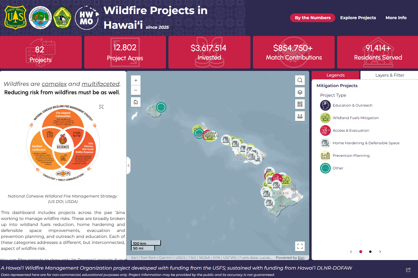
The Mitigation Dashboard provides an interactive look at selected wildfire mitigation and risk-reduction projects across Hawaiʻi. Explore project locations, activities, investments, and accomplishments to see how communities, organizations, and partners are working to reduce wildfire vulnerabilities.
The dashboard primarily highlights projects involving HWMO, DLNR-DOFAW, U.S. Forest Service funding, and Firewise Program partners. It does not represent every wildfire mitigation effort underway across the state.
Future updates may include additional projects. If your organization is involved in wildfire mitigation work and would like your project considered for inclusion, please contact admin@hawaiiwildfire.org.
Wildfire StoryMaps
Explore the Stories
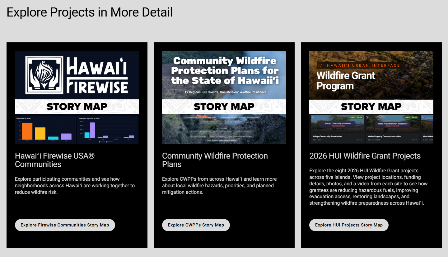
The Wildfire StoryMaps highlight wildfire preparedness, planning, and mitigation efforts across Hawaiʻi through interactive maps, photographs, project information, and community stories.
Explore how communities and partners are taking action through Firewise communities, the Hawaiʻi Urban Interface (HUI) Wildfire Grant Program, and Community Wildfire Protection Plans (CWPPs).
HWMO has received funding to update CWPPs across Hawaiʻi and is currently working to incorporate the latest available information to reflect current wildfire conditions, community needs, and mitigation priorities.
Data Use & Resources
Understanding Wildfire Hazard, Risk, and Responsible Data Use
HWMO's wildfire mapping resources are designed to support education, community planning, mitigation prioritization, and wildfire risk-reduction efforts across Hawaiʻi. Understanding what these resources represent, how they were developed, and their intended uses and limitations is essential to interpreting the information accurately.
Understanding Wildfire Hazard vs. Risk
Although closely related, wildfire hazard and wildfire risk are not the same thing.
Wildfire Hazard
The presence and characteristics of conditions that may contribute to wildfire occurrence or impacts, including vegetation, terrain, weather patterns, historical ignitions, and characteristics of developed communities.
Wildfire Risk
The likelihood and potential consequences of wildfire under specific conditions. Risk is influenced by underlying hazards as well as changing environmental conditions, status of vegetation management and conditions of building materials, and actions taken to reduce risk.
Two communities may have similar wildfire hazard conditions but different levels of risk due to differences in building materials, vegetation management, home hardening, fire suppression response time and capacity, and status of risk reduction and mitigation efforts.
A wildfire hazard classification is not a wildfire risk rating. The Hawaiʻi Community Wildfire Hazard Inventory does not determine property-specific wildfire risk or predict damage or loss.
Hawaiʻi Community Wildfire Hazard Inventory: Data Use & Limitations
The Community Wildfire Hazard Inventory characterizes wildfire hazard conditions within assessed developed communities across Hawaiʻi. It is intended to support education, awareness, planning, and mitigation prioritization, not property-specific risk determinations.
Official Map Disclaimer
For education and planning only. Not a risk assessment or prediction and not intended for insurance or regulatory use. Shows wildfire hazard indicators in developed areas only; wildland areas were not assessed for this project. Inventory metrics focus on the fire environment and overall community structure. Published 2026.
Appropriate Uses
The Inventory is intended to support:
Education and awareness about wildfire hazard characteristics.
Community and statewide planning discussions.
Identification of areas for further analysis and mitigation prioritization.
Coordination among communities, agencies, and organizations.
Strategic discussions about wildfire mitigation funding and investments.
The Inventory should be considered one source of information alongside local knowledge, additional assessments, and other relevant planning resources.
Inappropriate and Unsupported Uses
The Inventory was not developed or validated for:
Predicting wildfire occurrence, property damage, or loss at an individual location.
Assigning property-specific wildfire risk ratings or determining structure survivability.
Making insurance underwriting, coverage eligibility, or premium determinations.
Determining property values or insurability based on mapped hazard classifications.
Making parcel-level regulatory compliance or code enforcement determinations.
Treating hazard classifications as comprehensive measures of wildfire risk.
Replacing site-specific assessments or other specialized wildfire analyses.
Using the Inventory beyond its intended purpose may lead to inaccurate or misleading conclusions.
Important Data Limitations
Geographic Scope
The Community Wildfire Hazard Inventory focuses on assessed developed communities and the built environment. Undeveloped wildland areas were not assessed as part of this project. The maps should not be interpreted as comprehensive landscape-scale wildfire hazard or fire behavior assessments.
Changing Conditions
Weather, vegetation, development, building improvements, and wildfire mitigation activities may change conditions over time. The maps reflect the datasets and assessment methods used during their development and may not represent current conditions or more recent improvements.
Data Accuracy and Completeness
The Community Wildfire Hazard Inventory relies on available datasets and assessment methodologies that may contain uncertainties, limitations, or gaps. The information should not be assumed to reflect every condition at a particular location.
Map Classifications
Map colors and ratings represent the specific hazard characteristics evaluated. They do not represent overall wildfire risk classifications or predict wildfire damage or loss. For example, an ingress/egress hazard rating describes evaluated road-network characteristics, not the probability of wildfire occurrence or the overall wildfire risk of individual properties.
Responsible Interpretation and Sharing
Users should review applicable map legends, methodologies, and limitations before interpreting, downloading, reproducing, or sharing Inventory information. Maps, screenshots, and data should not be presented without sufficient context to explain their meaning and limitations.
Mitigation Dashboard & Wildfire StoryMaps: Information and Limitations
The Mitigation Dashboard and Wildfire StoryMaps highlight selected wildfire mitigation, preparedness, and planning efforts across Hawaiʻi. They provide information about documented projects and community activities but do not represent every wildfire mitigation effort underway across the state.
Project information reflects available documentation and reporting and may be updated over time. The absence of a project from these resources does not necessarily mean wildfire mitigation work has not occurred in that area.
These resources are intended to support awareness and education about ongoing efforts HWMO and our funding partners are involved in, not to establish the overall wildfire risk of individual communities or properties or guarantee protection from future wildfire impacts.
Methodology & Technical Resources
The Hawaiʻi Community Wildfire Hazard Inventory was developed using geographic information systems (GIS), updated datasets, and Hawaiʻi-specific assessment methodologies.
Supporting documentation provides additional information about the evaluated hazard characteristics, data sources, assessment methods, rating classifications, and limitations.
Questions About These Resources?
For questions about the Inventory, the Mitigation Dashboard, Wildfire StoryMaps, or appropriate interpretation of the information, contact the Hawaiʻi Wildfire Management Organization at admin@hawaiiwildfire.org.