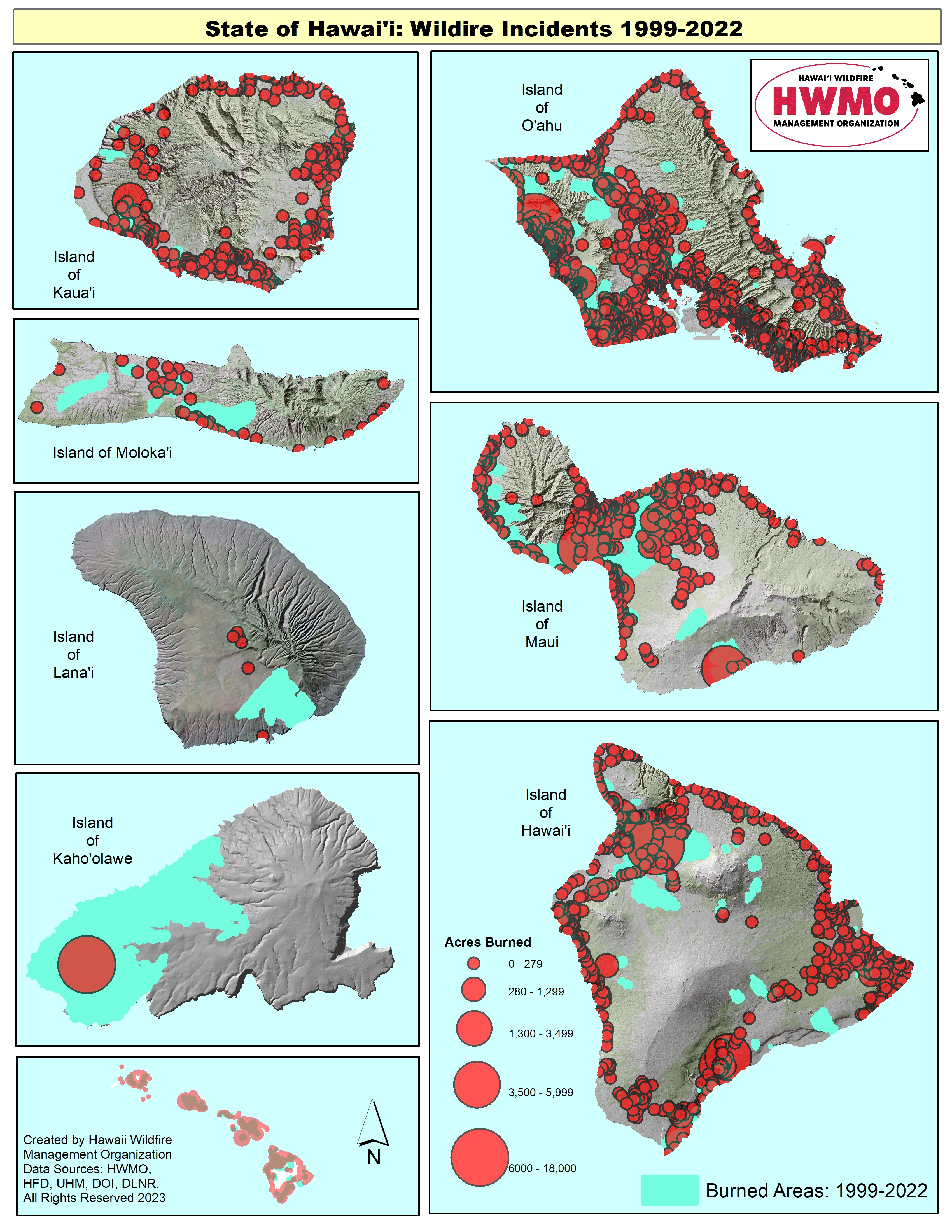
State of Hawaii Wildfire History Map (1999-2022)
Understanding patterns and trends of fire behavior on the islands will help land managers, firefighters, communities, decision-makers, and fire scientists in nearly infinite ways.
Comprehensive fire histories had existed in every state, except Hawaii, until HWMO took charge this past decade. HWMO staff spent countless hours putting together a massive spreadsheet with the records that they data checked and geo-located fire by fire.
With this data, HWMO has created fire history maps for each major Hawaiian island, as seen on the front page. These maps are still in draft stages, as not all of the data were easily mapped or readily located geographically based on fire records. The staff continues to work through existing information and adding wildfire ignitions to the maps. This map is an update to the previous wildfire incident map published in 2014.