Hawaii Wildfire Interactive Web App
Why a Hawaii Wildfire web app?
As an organization that serves all who live, work, or visit the Hawaiian Islands and parts of the Western Pacific, we want to make wildfire-related information readily available at your fingertips. We hope this app will be useful for you to learn more about the wildfire hazards in your own area so that you will be better equipped to take action in your community.
What does the Hawaii Wildfire web app do?
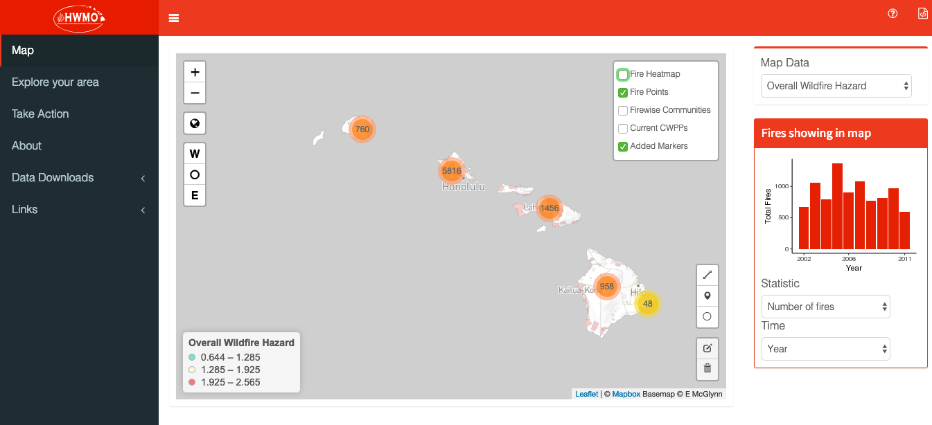
The Hawaii Wildfire webapp visualizes wildfire data across Hawaii. It has four types of data: fire history, community hazard assessments, community input information, and census data.
Knowledge is power!
We want to say a big thank you to Niklas Lollo and Evangeline McGlynn, PhD candidates at the University of California, Berkeley, for developing the app in conjunction with Data Sciences for the 21st Century. Their hard work and dedication to this app no doubt shows in the final result.
If you have any questions or feedback, you can e-mail HWMO at admin@hawaiiwildfire.org or call (808) 885-0900.